
A site can be well built, carefully maintained, and commercially valuable yet still be difficult to understand from a distance. A decision-maker in Lagos may need to review a facility in Douala. An investor abroad may want evidence of a development’s current condition. A project team may need to compare completed work against an earlier milestone without arranging another site visit.
That is the practical context for what is reality capture. It is the process of recording a real-world space, asset, or site with digital tools so it can be accurately viewed, measured, documented, and analyzed remotely. The result is more than a collection of photos. Depending on the project, it can become an interactive 3D walkthrough, a measurable point cloud, a floor plan, a site record, or a digital twin that supports ongoing operations.
For property, infrastructure, hospitality, automotive, construction, and public-sector teams, reality capture turns physical access into digital access. It creates a credible visual reference that can be shared with stakeholders without relying solely on written reports, static images, or memory.
What Is Reality Capture?
Reality capture combines capture hardware, spatial data, imagery, and processing software to create a digital representation of a physical environment. The capture may cover a hotel, office, warehouse, showroom, road corridor, construction site, heritage location, utility facility, or an individual asset.
The term is broad because the right output depends on the decision that needs to be made. A real estate developer may need an immersive virtual walkthrough that helps remote prospects understand layout and finishes. A construction manager may need recurring 3D records to evidence progress at defined milestones. A facilities team may need a structured visual baseline for maintenance planning, handover, or incident review.
A useful way to think about it is this: photography shows what a place looked like from selected viewpoints. Reality capture records enough spatial context to help users move through, inspect, orient themselves within, and sometimes measure the place after the capture team has left.
The Technologies Behind Reality Capture
Reality capture is not one camera or one file format. It is a workflow that can combine several technologies, selected according to the site, required accuracy, audience, and budget.
360-degree imaging and immersive walkthroughs
High-resolution 360-degree imagery allows a user to look around from fixed positions inside a space. When those positions are connected, they form an interactive walkthrough. Users can navigate rooms, inspect finishes, understand adjacencies, and access tagged information through interactive hotspots.
This approach is highly effective for apartments, offices, hotels, retail sites, clinics, dealerships, and cultural venues. It prioritizes ease of access and visual communication. It is usually faster and more economical than survey-grade scanning, but it should not be treated as a substitute for engineering measurement where strict dimensional accuracy is required.
LiDAR and laser scanning
LiDAR, short for Light Detection and Ranging, uses laser pulses to measure distances and generate dense collections of spatial coordinates called point clouds. These point clouds can represent walls, floors, structural elements, equipment, and terrain in three dimensions.
LiDAR mapping is valuable when geometric accuracy matters. Architects can use it as a basis for existing-condition modeling. Industrial teams can document plant rooms and complex equipment areas. Infrastructure and construction stakeholders can create reliable baseline records before work begins.
The trade-off is that LiDAR outputs require more specialized processing and interpretation than a simple virtual tour. The resulting dataset can be extremely useful, but its value depends on a clearly defined purpose and a team that knows how it will be used.
Photogrammetry
Photogrammetry creates 3D models from overlapping photographs. Software identifies matching points across images and reconstructs the geometry and surface appearance of an object, building, or site.
It is especially useful for exterior environments, facades, large sites, and heritage documentation. Drone-based photogrammetry can also support progress monitoring and mapping where site conditions and aviation rules allow. Image quality, lighting, coverage, and control points all affect the final output, so field planning matters.
Digital twins and structured data
A digital twin is often discussed as if it were simply a 3D model. In practice, the useful distinction is data connection. A digital twin can link the visual representation of a space to information such as asset details, maintenance records, inspection notes, project milestones, documents, or operational instructions.
Not every project needs a fully integrated digital twin. A marketing-ready walkthrough may be the right deliverable for a property launch. A multi-site institution, however, may benefit from a secured visual environment where teams can locate assets, review condition records, and maintain a more durable archive.
From Site Visit to Usable Digital Record
A strong reality capture project begins before equipment arrives on site. The first question is not, “What camera should we use?” It is, “What decision should this digital record support?” That answer determines the capture method, level of detail, access requirements, and deliverables.
For example, a hotel seeking more direct bookings may prioritize guest-facing navigation, polished imagery, and key booking or amenity information. A construction project may prioritize repeatable capture positions, date-stamped milestones, and side-by-side comparison. A development program may require evidence that can be securely shared with funders, partners, and field teams.
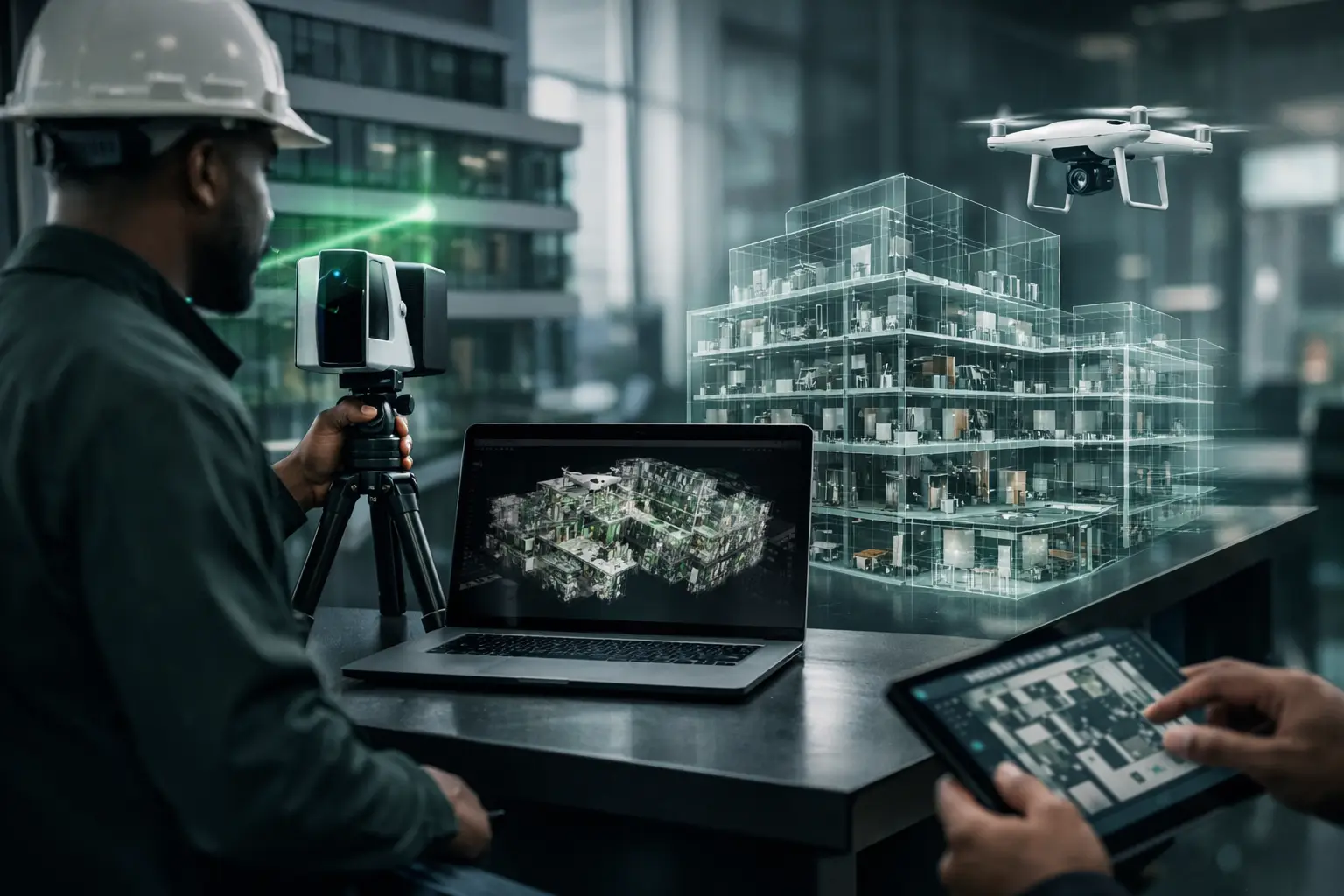
The field team then captures the environment systematically. This may involve positioning 360 cameras throughout interiors, scanning defined areas with LiDAR, photographing assets, flying approved drone routes, or recording contextual details that will later appear as labels and hotspots.
After capture, the raw data is processed into the agreed format. That can include a 3D walkthrough, dollhouse view, floor plan, point cloud, virtual staging, Google Street View-ready imagery, visual progress report, or a cloud-hosted digital twin. Quality assurance is essential here. Navigation should be intuitive, sensitive information should be handled appropriately, and the final environment should reflect the site as it was captured rather than an idealized version of it.
Where Reality Capture Creates Business Value
Reality capture earns its place when it reduces uncertainty or avoids unnecessary travel, rework, and delay. Its commercial value is not limited to presentation, although presentation matters.
For real estate and hospitality, it gives prospective tenants, buyers, guests, and corporate clients a more credible way to evaluate a space remotely. A visitor can understand room flow, conference capacity, views, vehicle display areas, or the relationship between a lobby and amenities before requesting a physical viewing. This often leads to better-qualified inquiries because expectations are clearer.
For construction and infrastructure, recurring capture creates a visual timeline. Teams can review installation status, communicate updates to remote stakeholders, document concealed conditions before finishes are applied, and preserve evidence of site progress. It does not replace professional site supervision or contractual certification, but it can make reporting more transparent and easier to verify.
For facilities and industrial operations, an accurate visual record helps teams orient contractors, plan interventions, document equipment locations, and retain knowledge when personnel change. In large or geographically dispersed portfolios, this can make remote collaboration materially more efficient.
For public institutions, NGOs, and heritage organizations, reality capture can support accountability and access. A documented project site can be reviewed by partners who cannot travel. A cultural venue can be made accessible to students, diaspora communities, and researchers. A baseline record can also preserve conditions before renovation, relocation, or environmental change.
Choosing the Right Level of Capture
More detail is not automatically better. A survey-grade point cloud may be excessive for a small rental listing, while a consumer-grade virtual tour may be inadequate for documenting a complex industrial facility. The appropriate approach depends on the decisions at stake.
Start with four practical questions: Who needs access? What do they need to see or verify? How accurate must the record be? And how long must it remain useful? A one-time campaign can prioritize speed and visual impact. A capital project or multi-location portfolio may justify a more structured capture plan, consistent naming, secure hosting, and scheduled updates.
Access conditions also matter. Active construction sites, sensitive facilities, occupied hotels, and public infrastructure each require different protocols. Privacy controls, restricted areas, operational schedules, and stakeholder permissions should be addressed during scoping, not after publication.
Reality Capture Is Evidence, Not Just Visual Content
The strongest reality capture programs treat visual data as part of business infrastructure. They establish a repeatable way to document sites, communicate status, and make spaces accessible across distance.
For African organizations working with regional teams, international investors, funders, or dispersed operational partners, this capability can close a persistent visibility gap. IMMOBITRON applies immersive 3D capture, LiDAR mapping, and structured digital documentation to make physical environments easier to review, present, and manage on credible terms.
The most useful next step is not to capture everything. It is to identify the space, asset, or project milestone where better visual evidence would change the quality or speed of a decision, then build the digital record around that need.