
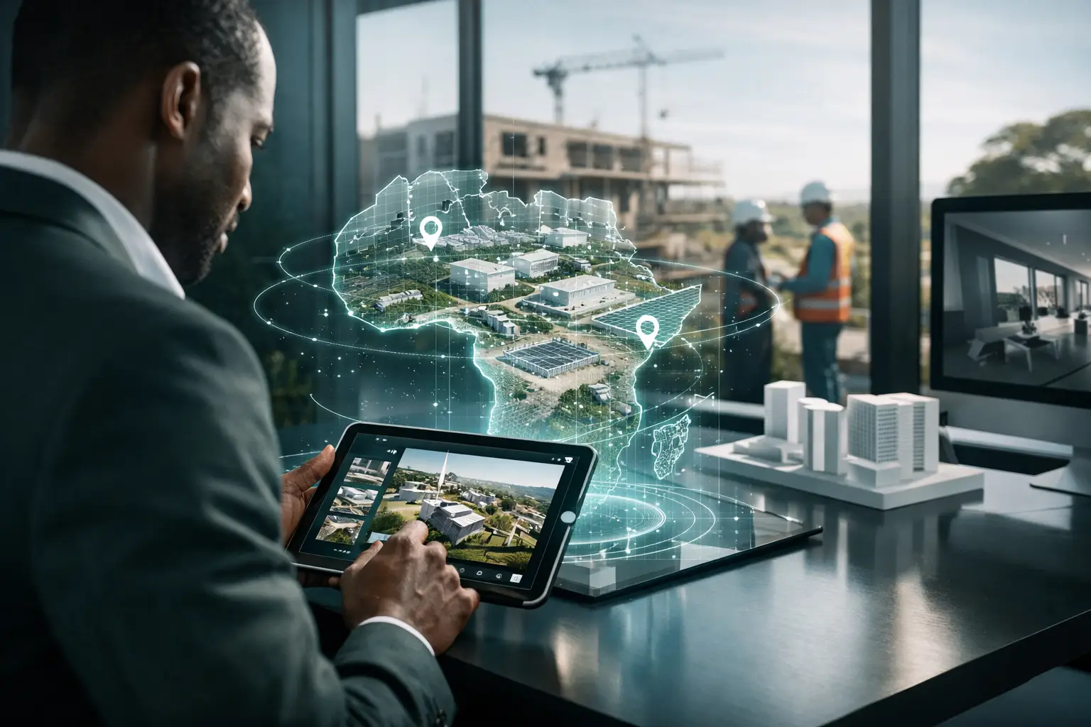
A funder in Nairobi, a project director in Yaoundé, and a technical partner in Lagos may all need to assess the same site without arriving on the same day. A construction update made of a few selective photos and a short narrative rarely gives them enough confidence. Visual proof for development projects creates a navigable, time-stamped record of what exists, what has changed, and what still requires attention.
For developers, NGOs, infrastructure agencies, and institutional teams, this is not simply a communications asset. It is operational evidence. When captured correctly, an immersive 3D environment, structured photography, floor plans, and milestone comparisons make it easier to review progress remotely, answer stakeholder questions, preserve baseline conditions, and support decisions with a shared source of truth.
Why visual proof changes project oversight
Development projects operate across distance, changing site conditions, and complex approval structures. Decision-makers often receive updates after a milestone has passed, through reports that cannot fully show access constraints, installation quality, material storage, completed zones, or unfinished work. The result is avoidable uncertainty: people debate what was observed instead of deciding what to do next.
A visual record changes that dynamic. It gives stakeholders controlled access to the physical reality of a site, allowing them to move through key spaces, inspect documented areas, and revisit a specific condition after a meeting has ended. Unlike a single image, a virtual walkthrough provides context. It shows what is beside, behind, above, and connected to the item being reviewed.
This matters particularly for projects involving dispersed funders, government partners, consultants, contractors, and community stakeholders. Travel remains valuable for high-risk inspections and critical approvals. Yet it is not always necessary for every review. High-quality visual documentation helps teams reserve physical site visits for the decisions that truly require them.
What credible visual proof for development projects includes
Not every project needs the same documentation depth. A donor-funded school rehabilitation program may require clear before-and-after evidence across many sites. A new commercial development may need frequent visual updates for investors and sales teams. A transport, utilities, or industrial project may prioritize restricted-access records, asset traceability, and technical review.
The common requirement is credibility. That comes from a planned capture method rather than occasional site photography.
A defensible baseline
The first capture should document the site before major intervention begins, or as close to project mobilization as possible. This baseline can show existing structures, access routes, adjacent conditions, drainage, finishes, equipment, and visible defects. It creates a reference point for future progress reviews and can help resolve later questions about pre-existing conditions.
A 3D digital twin is especially useful at this stage because it provides spatial context. Reviewers can understand the layout of a facility, follow circulation paths, and identify the relationship between rooms, components, or work zones. LiDAR-based spatial capture strengthens dimensional understanding and can support floor-plan views where appropriate.
Milestone captures with consistent viewpoints
Progress evidence is only useful when stakeholders can compare like with like. Capturing a site at defined milestones, using repeatable coverage and agreed priority zones, makes change visible. Teams can document foundations, structure, enclosure, mechanical and electrical installation, finishes, commissioning, and handover readiness according to the project scope.
Consistency does not mean every site must be scanned every week. The right frequency depends on project duration, risk level, reporting requirements, budget, and the pace of work. A rapid fit-out may justify frequent capture. A long infrastructure program may benefit more from baseline, key construction milestones, and completion documentation.
Structured details, not just panoramic views
Immersive walkthroughs give broad context, but close-up photography still has a role. High-resolution images can document serial numbers, signage, material condition, equipment installation, inaccessible areas, or specific observations identified by the project team. Interactive hotspots can add labels, drawings, technical notes, videos, or approved documents directly within the relevant location.
This creates a more usable record than a folder of unconnected images. A stakeholder can see a photographed detail, understand where it sits in the building or site, and review the associated note without searching through email threads.
Secure access and clear ownership
Project evidence often contains sensitive information: security arrangements, operational layouts, equipment, personal data, or work in progress. The platform should therefore support controlled sharing, secure cloud hosting, and clearly defined access permissions. Public visibility may be appropriate for a completed cultural site or tourism facility. A live construction record usually requires a more selective audience.
Teams should also agree on record ownership, retention periods, file formats, and handover expectations at the start. Visual documentation has long-term value for facility managers and asset owners, but only if it remains accessible after the construction team has demobilized.
From site capture to stakeholder-ready reporting
The strongest visual evidence is planned before the camera arrives on site. It begins with a short scoping conversation that identifies the decision-makers, the questions they need answered, the reporting calendar, and the areas that carry the greatest delivery risk.
For example, an agency delivering health facilities across several regions may need a standardized capture brief for every location. The brief can define entrance views, patient areas, technical rooms, accessibility features, water points, solar installations, and exterior works. This consistency allows program managers to review sites fairly and prepare reports with comparable evidence.
A private developer may organize the same process around construction packages and investor updates. The priority could be the lobby, sample apartment, parking, retail frontage, amenities, and views from key units. The visual record then serves both project governance and commercial presentation, with access separated according to audience.
After capture, the material should be processed into an organized digital environment rather than delivered as raw media alone. A stakeholder-ready output typically combines an immersive 3D walkthrough with annotated locations, high-resolution supporting images, floor-plan or dollhouse views, and a concise visual report tied to the agreed milestone. This gives executives a fast overview while preserving enough detail for technical teams.
Where visual evidence delivers the most value
The value is highest where absence creates friction. International investors can assess commercial space before scheduling a visit. NGO and development-program leaders can validate field activity across dispersed locations. Public institutions can create durable records of facilities, markets, heritage assets, and community infrastructure. Construction managers can bring remote architects, quantity surveyors, and client representatives into a guided 3D review.
It can also improve handover. A final capture documents the as-delivered condition of a building or facility at a specific moment. Operations teams can use it to familiarize staff with spaces, plan maintenance activity, locate equipment, and preserve a visual archive before future alterations occur.
There are limits. A 3D walkthrough cannot certify concealed work, replace professional testing, or substitute for a statutory inspection. It should support qualified judgment, not imitate it. For technical verification, combine visual documentation with site reports, measurements, test results, approved drawings, and in-person inspections where risk warrants them.
Choosing the right level of capture
A practical approach starts with the decision, not the technology. Ask what a remote stakeholder must be able to see, compare, approve, or question. Then define the coverage, level of detail, capture intervals, annotations, access controls, and final deliverables needed to support that action.
A small renovation may only need a baseline capture, a midway review, and a final walkthrough. A multi-site education, housing, or health program may require a repeatable documentation framework across dozens of locations. Large industrial and infrastructure assets may need custom scoping, including priority equipment, restricted zones, external works, and integration with existing reporting procedures.
IMMOBITRON approaches this work as spatial intelligence and structured documentation, not as a one-time virtual tour. The goal is to make a physical project accessible and evidential for the people responsible for funding, delivery, oversight, and long-term operations.
The most useful project record is created before a disagreement, delayed approval, or missed site visit makes it necessary. When the next stakeholder asks what has changed on the ground, the answer should be more than a claim in a report. It should be a clear environment they can inspect, discuss, and use to move the project forward.