
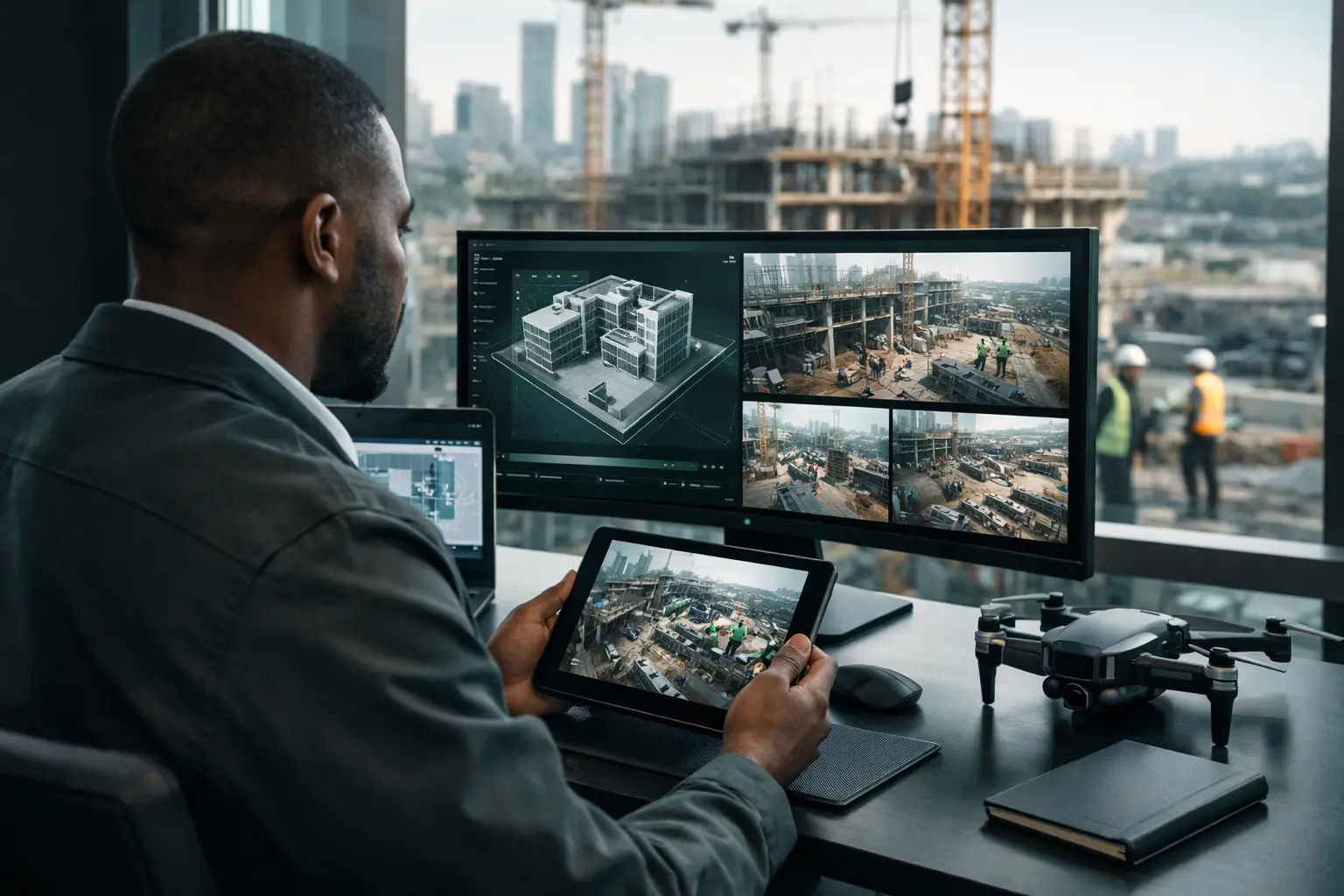
A project can look on schedule in a written update while a critical slab, utility route, façade detail, or access road tells a different story. Site monitoring turns those physical conditions into evidence that stakeholders can review without waiting for a site visit. For developers, contractors, funders, facilities teams, and public institutions, that changes how quickly decisions can be made and defended.
The objective is not simply to collect images. Effective monitoring creates a consistent, time-stamped visual record of a site as it evolves. It gives dispersed teams a shared point of reference, helps identify deviations before they become expensive, and provides credible documentation for people who need visibility but cannot be present every week.
What Site Monitoring Should Deliver
Construction and asset projects generate reports, schedules, meeting notes, and photographs. Each has value, but they often sit in separate files and fail to show the practical relationship between a planned milestone and the condition on the ground. A well-designed monitoring program connects visual evidence to project stages, locations, and decisions.
At minimum, stakeholders should be able to see what existed at a given date, compare it with a previous capture, and understand where the image was taken. For more complex projects, an interactive 3D digital twin can add navigable context. A project director in Lagos, an investor abroad, and a technical consultant in another city can move through the same environment, inspect key areas, and discuss a specific condition without relying on vague descriptions.
This is particularly useful where projects involve multiple contractors, long supply chains, remote sites, or regular reporting to funders and agencies. In these environments, visibility is not a presentation feature. It is part of project control.
Why Visual Evidence Changes Project Control
Progress reports are usually prepared after work has happened. Their usefulness depends on the accuracy of the person writing them and the clarity of the information they receive. Visual records do not replace professional judgment, site supervision, or quantity verification. They make those conversations more grounded.
When a team can revisit the same area at each milestone, it can document completed work, identify blocked activities, and examine changes in site logistics. A delayed delivery, incomplete installation, or inaccessible workfront becomes easier to explain with a dated visual reference. This reduces the back-and-forth that occurs when teams are working from disconnected phone images or recollection.
Visual site monitoring also supports accountability. If a question arises about the condition of a space before a handover, alteration, or repair, an organized archive can establish a reliable baseline. That can be valuable for contractor coordination, claims discussions, maintenance planning, insurance reviews, and institutional reporting.
There is a practical trade-off: more frequent capture creates a richer record but also requires stronger organization and a clear purpose. Weekly documentation may be appropriate during rapid structural or fit-out activity. Monthly capture may be sufficient for a slower civil works program or a stable operational facility. The right cadence follows the risk, pace, and reporting requirements of the project.
Build a Monitoring Plan Before the First Capture
The most useful monitoring begins before construction advances beyond the first visible milestone. A baseline capture records existing conditions, neighboring properties, access points, utility interfaces, and the original state of structures that may be altered or protected. Without that baseline, later comparisons lose much of their value.
Define the decisions the record must support
Start with the questions stakeholders need answered. A developer may need proof of progress for investor updates. A construction manager may need a reliable visual reference for coordination meetings. An NGO or development program may require evidence that a funded facility reached specific milestones. A facilities team may be documenting equipment rooms, circulation routes, and finishes before occupation.
Those goals determine what should be captured. A marketing-oriented tour of a finished property is not enough for a construction record. Monitoring may need attention to technical rooms, roof areas, service corridors, foundations, external works, safety interfaces, or areas that will later be concealed.
Establish repeatable viewpoints and routes
Consistency matters more than sheer volume. Captures should follow a defined route and include agreed viewpoints so teams can compare like with like. A recurring view of the entrance, primary structure, service core, storage area, and external works can reveal change far more clearly than a large folder of unstructured images.
For complex sites, LiDAR-supported 3D capture provides spatial context that standard photography cannot. It enables users to navigate the environment, understand scale and adjacency, and locate observations within the site rather than interpreting isolated images.
Assign ownership and access rules
Someone must own the monitoring calendar, capture standards, review process, and archive. This does not mean one person must inspect every issue. It means the record has a defined custodian and does not disappear into individual phones, email threads, or contractor folders.
Access should match the project. Senior management may need broad remote visibility, while sensitive facilities, public infrastructure, or institutional projects may require controlled viewing permissions. Secure hosting and structured user access protect the value of the record without limiting legitimate collaboration.
Use the Record During the Project, Not Only at Handover
A common mistake is treating visual documentation as something to assemble for a final report. Its greatest value comes from regular use in live project management. Before a coordination meeting, teams can review the latest capture and mark the spaces requiring discussion. During a remote review, participants can move through the digital environment together, reference a location precisely, and agree on follow-up actions.
Interactive hotspots can add useful context where it is needed. A hotspot may identify a completed milestone, link a room to an equipment schedule, flag an observation, or explain a change in scope. The goal is not to overload the model with annotations. It is to make key information easier to retrieve when decisions are being made.
Visual reporting is especially effective for stakeholders who do not need a technical site briefing but do need credible proof of activity. Funders, boards, investors, and partner organizations can see project advancement in a format that is more immediate than a dense spreadsheet. For projects spread across regions, this reduces the cost and delay of arranging repeated physical visits while preserving a meaningful level of oversight.
Still, remote visibility has limits. A digital twin can show condition, layout, access, and visible progress, but it cannot certify structural quality, hidden services, material compliance, or safety performance on its own. Monitoring works best alongside site inspections, engineering reviews, quality assurance procedures, and formal project controls.
From Construction Record to Operational Intelligence
The value of a site record does not end when the project is complete. At handover, the final digital environment can become a practical reference for operations, leasing, asset management, and future modifications. It can help a property manager orient new teams, support remote tenant discussions, document finishes, or provide a baseline before maintenance work begins.
For hospitality spaces, commercial buildings, dealerships, and public facilities, the same environment can serve several audiences with appropriate access and presentation. Operations teams may use it as a reference archive, while commercial teams use selected views to present the facility remotely. This creates more value from the same capture effort, provided the monitoring plan has considered both technical documentation and future usability.
IMMOBITRON approaches this work as spatial intelligence rather than a one-time virtual tour. The deliverable should help teams document what is real, communicate what has changed, and make informed decisions from wherever they are.
A useful next step is to identify the next milestone where missing evidence would create risk. Establish the baseline or recurring capture before that date. Once a project has a disciplined visual record, conversations become less about what people believe happened on site and more about what the site can clearly show.