
A site visit can answer a question in minutes, but it may take days to arrange when decision-makers are in different cities or countries. A Building Digital Twin or Jumeau Numérique Bâtiment changes that equation by creating an accessible, evidence-based digital representation of a physical building. For developers, facilities teams, public institutions, and project partners across Africa, it turns a hard-to-reach asset into a space that can be reviewed, discussed, documented, and managed remotely.
This is more than a polished virtual tour. When planned around operational needs, a digital twin becomes a durable visual record that supports property presentation, construction oversight, asset documentation, and stakeholder communication.
What Is a Building Digital Twin?
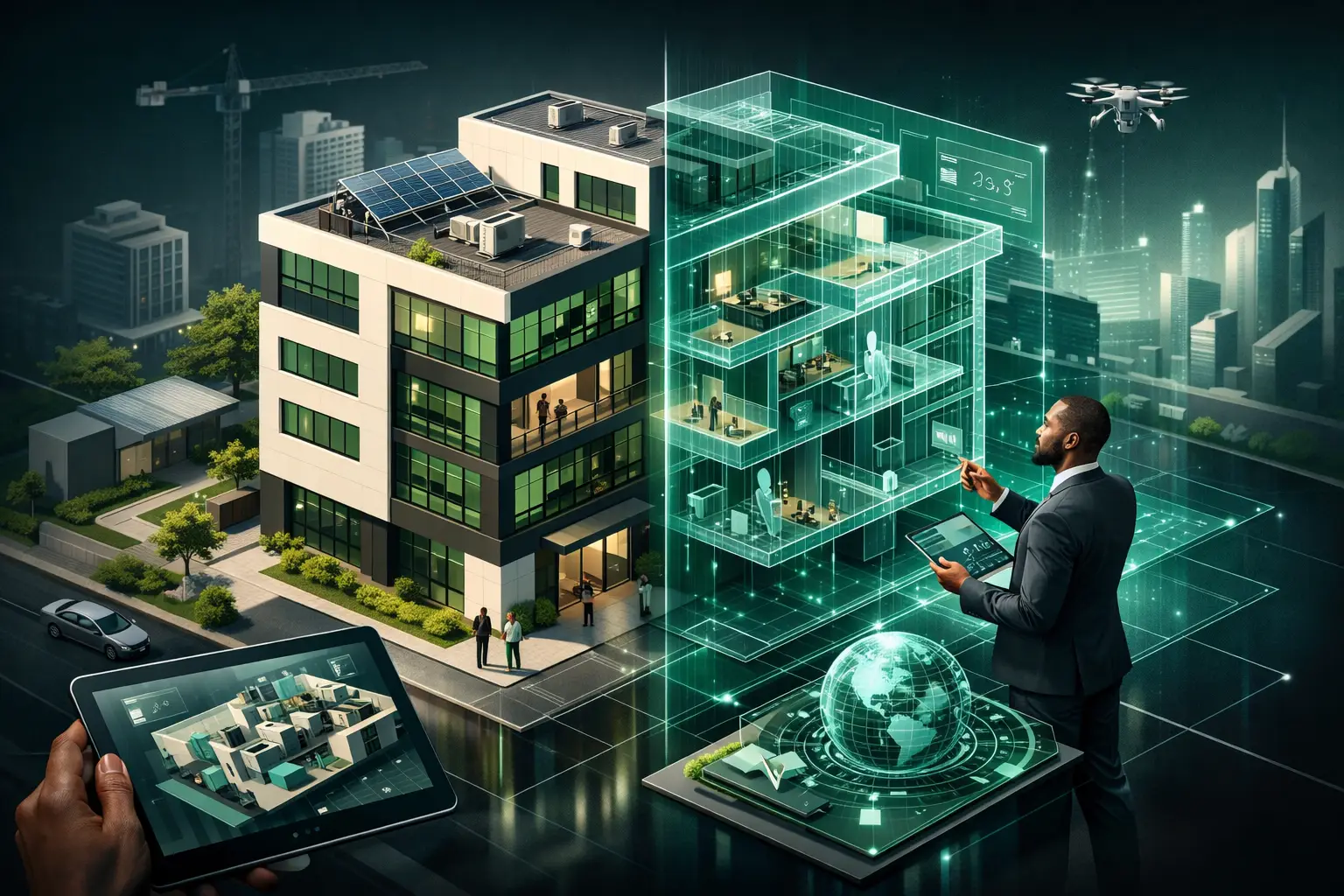
A building digital twin, is a digital representation of a real building or site. It can combine immersive 3D walkthroughs, LiDAR-based spatial capture, floor plans, high-resolution imagery, measurements, tagged information, and progress records. Users can move through the environment remotely and examine the areas that matter without relying only on written reports or static photographs.
The depth of the twin depends on the project. A commercial property may need an interactive 3D experience that helps prospective tenants understand circulation, finishes, views, and unit layouts. A construction program may need repeated captures at defined milestones to show progress against a baseline. A public agency or NGO may require a structured visual archive to support handover, donor reporting, compliance review, or maintenance planning.
The central value is not simply visualization. It is shared spatial evidence. Instead of asking a stakeholder to interpret a description of a plant room, a road facility, a hotel wing, or a warehouse, teams can bring that stakeholder directly into a documented digital environment.
A Virtual Tour Is Not the Same as a Digital Twin
The terms are often used interchangeably, but the distinction matters when an organization is defining scope and budget. A virtual tour is generally designed for exploration and presentation. It is highly valuable for real estate marketing, hospitality sales, showroom visibility, and remote orientation.
A digital twin can include that experience, but it is designed around an additional purpose: maintaining a useful connection between the physical asset and its digital record. It can be organized by zones, linked to drawings and documentation, captured repeatedly over time, and used as a reference point for inspections, handovers, or internal planning.
That does not mean every asset needs a complex, data-heavy twin. A small office available for lease may benefit most from an accurate 3D walkthrough, floor plan, and professional photography. A large hospital, mixed-use development, industrial facility, or infrastructure program may justify a deeper documentation model with milestones, asset categories, restricted access, and structured reporting. The right approach depends on the decisions the digital record must support.
Why Digital Building Records Matter in African Markets
Physical distance is a recurring business constraint. Investors may be based outside the country. Diaspora buyers may need confidence before traveling. Technical consultants, funders, regulators, and executive teams often need to review projects without coordinating repeated site visits. Even within a single city, traffic, access controls, safety requirements, and active works can make site access expensive and slow.
A well-produced digital twin improves access without pretending to replace every physical inspection. It gives remote stakeholders a credible first view, supports more focused site visits, and reduces the risk of decisions being made from incomplete visual information.
For property owners, this can improve listing quality and buyer confidence. For hotel operators, it can help sales teams present meeting facilities, rooms, amenities, and event spaces to corporate clients. For construction managers, it can create visual proof of site conditions at defined points in time. For public and development-sector programs, it can make completed works easier to communicate to funders, communities, and oversight teams.
There is also a practical documentation benefit. Buildings evolve. Fit-outs change, equipment is installed, repairs are completed, and spaces are repurposed. A structured capture made at handover or at a project milestone preserves a visual baseline that is difficult to recreate later.
The Building Lifecycle Use Cases That Deliver Value
Before construction: communicate the existing condition
Before renovation, expansion, or redevelopment begins, a 3D capture can document the condition of the site. This baseline is useful when teams need to compare existing layouts with proposed changes, explain constraints to consultants, or record conditions before contractors mobilize.
For heritage, civic, and cultural spaces, the baseline can be especially significant. Detailed spatial documentation provides a reference that can support conservation planning and wider access while limiting unnecessary foot traffic in sensitive environments.
During construction: create milestone evidence
Progress photos are common, but their context can be unclear. A digital twin captured at agreed stages allows stakeholders to navigate the project spatially and see what was completed as of a specific date. This makes visual reporting more informative for clients, lenders, consultants, and internal governance teams.
Repeated capture requires discipline. The team should agree in advance on milestone dates, priority areas, naming conventions, and the level of detail required. Without that structure, a collection of scans can become an archive that is visually impressive but operationally difficult to use.
At handover: strengthen the project record
Handover often involves drawings, manuals, spreadsheets, photographs, and folders held by different parties. A building digital twin can act as a visual front door to that documentation. Interactive hotspots can identify rooms, systems, equipment locations, finishes, or key reference files where appropriate.
The twin is not a substitute for formal as-built documentation, technical manuals, or statutory records. It makes those materials easier to contextualize. A facilities manager reviewing an equipment schedule can see where that equipment is located within the building rather than working from a drawing alone.
In operation: support remote review and asset management
Once a building is occupied, the twin can support tenant onboarding, facilities coordination, maintenance planning, and internal communication. A regional manager can review a branch, dealership, office, or facility without waiting for the next trip. A contractor can understand access routes and room relationships before mobilizing. A property team can share an accurate visual reference when discussing changes with owners or service providers.
The operational benefit is strongest when the digital twin is treated as a maintained information asset. Some sites need annual or periodic recapture; others need an updated record only after major renovations. The appropriate refresh cycle depends on how quickly the space changes and what decisions rely on its accuracy.
What a Useful Building Twin Should Include
The best deliverable starts with a defined business question. Are you trying to market a property, monitor progress, document a completed asset, improve remote collaboration, or preserve an existing condition? That answer determines what should be captured and how it should be organized.
For many projects, the essential components are an immersive 3D walkthrough, accurate floor-plan views, high-resolution still photography, and a secure cloud-hosted viewing environment. Larger or more technical engagements may add LiDAR mapping, measurement capability, dollhouse views, labels, interactive hotspots, guided remote walkthroughs, progress comparisons, and structured folders for supporting records.
Access settings matter as much as capture quality. A retail property may need a public-facing experience that is easy to share. An industrial facility, government office, or active construction site may require controlled access for named stakeholders. Organizations should establish who can view, download, annotate, or administer the record before publishing it.
How to Plan a Building Digital Twin Project
Start by identifying the audiences and the decisions they need to make. A marketing team, a project director, a funder, and a facilities manager may all use the same captured space differently. Their requirements should be aligned before fieldwork begins.
Next, define the capture boundary. The boundary may include buildings, floors, external areas, plant rooms, access routes, parking, or surrounding infrastructure. Areas with restricted access, security sensitivity, poor lighting, active work, or safety constraints should be identified early. Clear scoping protects both the quality of the deliverable and the efficiency of the site visit.
Then set the documentation structure. Agree on labels, zones, asset categories, milestone names, and any files or reports that should be referenced within the digital environment. This step is particularly valuable for multi-building portfolios and institutional projects, where consistency across locations makes future review far easier.
Finally, establish ownership and maintenance. Decide where the twin will be hosted, how long it must remain available, who manages user access, and when updates will be needed. A digital twin has the greatest long-term value when it is treated as part of the building record rather than a one-time media asset.
Choosing the Right Delivery Partner
Spatial capture is technical work, but reliable delivery also depends on field readiness, local operating knowledge, and a clear process for post-production and quality review. Teams should look for a partner that can work across active sites, coordinate with security and project personnel, define practical deliverables, and provide documentation that matches the intended use.
For pan-African portfolios, consistency is critical. A property group or development program should be able to compare captures across locations without encountering different standards, unclear naming, or uneven visual quality. At the same time, the delivery model must account for local site conditions, connectivity realities, safety requirements, and stakeholder expectations.
IMMOBITRON (immobitron.ai) approaches these engagements as spatial intelligence projects, combining immersive 3D capture, LiDAR-informed documentation, visual reporting, and practical consultation around how each record will be used.
A building becomes easier to manage when the people responsible for it can see it clearly, wherever they are. The most valuable digital twin is the one that gives the next stakeholder enough credible context to make a better decision before asking for another site visit.