
A property can look impressive in a brochure and still fail the remote buyer’s first test: Can I understand this place well enough to make a decision? When investors, tenants, funders, or partners cannot visit in person, how to present property remotely becomes a question of credibility, not just marketing. The goal is to give them context, scale, condition, and a clear path to the next decision.
For a commercial building in Douala, a hotel in Accra, a development site outside Nairobi, or a facility being reviewed by stakeholders overseas, a strong remote presentation reduces the uncertainty that slows approvals. It should let people inspect the environment on their own, ask informed questions, and retain a reliable visual record after the call ends.
Start with the decision the viewer needs to make
Remote presentation is more effective when it is designed around a specific decision. A prospective tenant needs to understand access, layout, fit-out potential, and surrounding activity. An international investor may need evidence of location, building condition, occupancy, and development progress. A project funder may be reviewing milestones against a stated scope. These audiences are not looking at the same property in the same way.
Before capture begins, define who will view the property, what they need to verify, and what action should follow. That action might be scheduling a live review, requesting commercial terms, approving a payment milestone, or shortlisting a site for an in-person inspection.
This framing prevents a common mistake: creating a visually attractive tour that does not answer material questions. A polished lobby matters, but a facilities team may care more about loading access, plant rooms, circulation routes, power infrastructure, or the condition of a roof.
Build the remote property presentation around evidence
Photos remain useful, but photos alone ask the viewer to trust the photographer’s selection and sequence. An immersive 3D walkthrough gives the viewer agency. They can move through rooms, compare adjacencies, revisit details, and develop a more realistic sense of the space.
The strongest remote presentation combines several visual layers, each with a specific job:
- An immersive 3D walkthrough for self-directed exploration
- High-resolution photography for key details, finishes, and exterior context
- Dollhouse and floor-plan views for layout and spatial relationships
- Interactive hotspots for specifications, documents, features, and points of interest
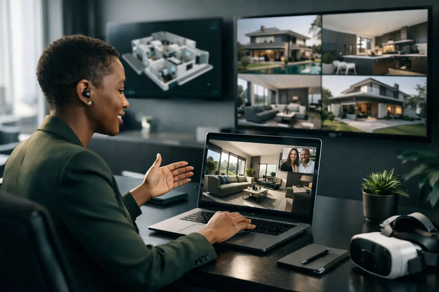
- A live guided 3D call for questions that require explanation in real time
A digital twin is particularly valuable when the property needs to serve more than marketing. It can become a reference environment for leasing, facilities coordination, design reviews, construction reporting, and stakeholder communication. Rather than creating a one-time campaign asset, the owner has a structured digital representation of the physical environment.
Capture the spaces that affect confidence
Remote viewers quickly notice what has been omitted. If the tour skips secondary corridors, back-of-house areas, washrooms, utility spaces, or access routes, they may assume those areas are problematic. That does not mean every presentation must expose every operational detail publicly. It means the capture plan should be deliberate.
For public marketing, lead with the spaces that sell the opportunity: arrival, main circulation, principal rooms, views, amenities, and relevant exterior areas. For qualified prospects or internal stakeholders, provide controlled access to deeper operational sections. Secure cloud hosting and permission-based sharing help organizations balance transparency with confidentiality.
Capture quality also matters. Poor lighting, distorted imagery, inconsistent navigation, or missing transitions undermine confidence, especially for a buyer comparing opportunities from another country. Professional spatial capture uses measured workflows, often supported by LiDAR mapping, to create accurate spatial relationships and stable navigation. The viewer should not have to work hard to understand where they are or how one area connects to another.
Tell the story in the order a visitor would experience it
A remote property presentation should follow a logical route, not simply display every room. Start with orientation. Show the approach to the property, the entrance, and the first major decision point. Then guide viewers through the primary spaces in a sequence that makes operational sense.
For a hotel, that may mean arrival, reception, public areas, room categories, meeting spaces, amenities, and service areas. For an office building, begin with exterior access and reception, then show typical floors, meeting areas, amenities, parking, and building services. For industrial or public infrastructure sites, the sequence may focus on site access, safety zones, key equipment, workflows, and documented milestones.
Add concise annotations where a visual alone may be ambiguous. A hotspot can identify floor area, ceiling height, installed equipment, completion status, room use, or a feature such as backup power. Do not overload the experience with sales language. The most useful annotations answer questions before they become objections.
Use live guided sessions for complex stakeholders
Self-guided exploration works well for early interest and broad distribution. Live guided 3D calls are better when a decision involves multiple stakeholders, detailed questions, or a complex site. During a guided session, the presenter can move through the same digital environment with participants, draw attention to relevant features, and adapt the discussion to what matters most to the room.
This is especially useful for dispersed teams. A developer, architect, lender, contractor, and diaspora investor can review a site together without arranging travel around a short meeting window. The session can focus on a leasing opportunity, a construction milestone, a design coordination issue, or a condition assessment.
Preparation still matters. Assign a moderator, set a clear agenda, and decide which locations must be covered. Send key dimensions, commercial information, or technical documents separately when required. A virtual walkthrough supports the conversation, but it does not replace due diligence documents, legal verification, engineering reports, or a physical inspection where those are necessary.
Present unfinished and changing properties honestly
Empty units, construction projects, and partially completed hospitality spaces can be difficult to market remotely because viewers struggle to imagine the finished result. Virtual staging can help them understand intended use, furniture scale, or the atmosphere of a completed space. Used well, it turns an abstract shell into a credible commercial proposition.
The boundary is simple: staged elements and future concepts must be identified clearly. Do not present a proposed fit-out as an existing condition. For construction and infrastructure projects, date-stamped visual documentation is more valuable than cosmetic polish. Capture the site at agreed milestones, maintain consistent viewpoints, and pair the visual record with progress notes where appropriate.
This approach gives funders, owners, and delivery teams evidence they can revisit. It also creates a baseline record that can support later inspection, handover, maintenance, or dispute resolution.
Make access easy, then measure engagement
A remote presentation fails if the intended viewer cannot access it easily. Test the experience on desktop and mobile devices, confirm that permissions work before a meeting, and provide a clear invitation that explains what the viewer will see. Avoid sending stakeholders a collection of large attachments with no context. A hosted interactive experience is easier to share, update, and control.
Audience analytics add another layer of intelligence. If a prospect revisits a particular floor repeatedly or spends time examining amenities, that interest can inform the follow-up conversation. At portfolio level, engagement patterns can help leasing and sales teams understand which sites, units, or features generate attention.
Analytics should guide outreach, not substitute for it. A viewer may be highly interested but unable to proceed because of internal approvals, budget timing, or local regulatory requirements. Use the data as a signal to ask better questions.
Treat the presentation as an operational asset
The best remote presentations remain useful after the first campaign. A digital twin can support tenant onboarding, facilities planning, asset inventories, condition documentation, project reviews, and public communication. It gives organizations a shared visual reference when teams are distributed across cities or continents.
For multi-location portfolios, consistency is a major advantage. When each property is captured to a comparable standard, decision-makers can review sites more efficiently and present a more professional record to investors, partners, or regulators. This is where a spatial intelligence partner such as IMMOBITRON can help translate capture into a durable documentation and communication system, rather than a standalone virtual tour.
The next time a key stakeholder says, “I need to see it before I can decide,” do not send them only a gallery of selected images. Give them a guided, evidence-rich way to understand the property from wherever they are - then make the next decision easier to take.